Tuesday, August 30, 2011

Formula 1 - Monza Italy 9-11 Sept. 2011

F1 Race Car - Ferrari

Monza / Italy
9-11 September 2011


After the dramatic race in Belgium circuit Spa-Francorchamps where Sebastian Vettel  was the winner with starting at pole position. 
Now the upcoimg race will be held at Monza-Italy where Ferrari is at home.
Last your the winner on this circuit was Fernando Alonso from Ferrari team.

The "La Pista Magica" (Magical Circuit) is the quickiest circuit in F1 where cars are racing with a top speed of 215 mph.

MONZA

Race Date:11 September 2011
Circuit Name:Autodromo di Monza
Number of Laps:53
Circuit Length:5.793 km
Race Distance:306.720 km
Lap Record:1:21.046 - R Barrichello (2004)


Friday, August 26, 2011

La Tomatina 2011

La Tomatina


La Tomatina is a "Food Fight" festival which is held each year on the last Wednesday of August. The city for this event is Buñol in the Valencia region of Spain. Tons of over-ripe tomatoes are thrown in the streets in exactly one,two,three,.......... : )) hour. This festival is a tradition in Buñol since 1944.


How started La Tomatina...?

The festival is in honor of the town's patron saints, Luis Bertran and the Mare de Deu dels Desemparats "Mother of God of the Defenseless".
The tomato fight has been a strong tradition in Bunol since 1944 or 1945. Actually,nothing is certain how this event started or become a tradition. There are  possible theories on how it began include a local food fight among friends or farmers, a juvenile class war, a volley of tomatoes from participantsof a carnival parade, a practical joke on a bad musician or muci group.

The most popular theory is that disgruntled townspeople attacked the cities councilmen with tomatoes during a town celebration. Whatever happened to begin the tradition, it was enjoyed so much that it was repeated the next year, and the year after that, and so on. 

Approximately 50,000 tourists come yearly to find out more about the tomato fight, and to participate.  For the La Tomatina  it is used about 150,000 tomatoes (90,000 pounds)

Where: The Plaza del Pueblo in Buñol, Spain.
              Buñol is roughly 40 km (25 mi) from Valencia.  

When: On the last Wednesday of August. The event lasts about 3 hours, from 11 am - 1 pm.
             The actual tomato throwing event lasts for one hour.


Getting There: Since Bunol is a small town with few hotels, it is better to stay in Valencia. There are trains (Renfe) departing each hour in direction to Bunol.

Thursday, August 25, 2011

PISA - Place of Miracles

Pisa

Pisa - The Place of Miracles
CAMPO DEI MIRACOLI

Pisa is the mostly known for the famous Leaning Tower. A tower which is standing more than 850 years (Construction begun in 1173). The tower begun already to lean while bulding the third gallery after five years. The building was left for a century, which allowed to suboil to stabilize itself which prevented the building to collapse because of weak/poor the fundation. When construction resumed in 1272 the upper floors were built with one side taller than the the other. Fınaly, the last floor which is the seventh floor was added in 1319  The tower stands 60 m, and was built to accomodate a total of seven bells.


The only historical monument is not only Pisa. This places is called "Campo dei Miracoli" which means Place/Field of Miracles. There are four buildings in total;


Campo dei Miracoli
2. The Cathedral (Duomo)
4. Campo Santo (Holly Field)


All architecture of the Campo dei Miracoli are made in "Romanesque" style. They incorporate intrictely carved column capitals supporting tall narrow arches.

The Cathedral which in the hearts of the place was entitled to Santa Maria Assunta. The construction begun in 1064 by the architect "Busketo".The construction took 54 years and was completed during the time of Pope Gelasius II.


Baptistery
The Baptistery was dedicated to St.John the Baptist, and stands as seen in picture on right opposite to the Duomo. The construction of this building begun in 12th century in 1153 and the architect was " Diotisalvi" (which means"God Save You"). This Baptistery is the biggest/largest within Italy.


Campo Santo
The "Campo Santo" (Holly Field) which is also known as the Monumental Cementery (Camposanto Monumentale) is located athe northern edge of the "Square". The construction of this Gothich Cloister began in 1278 by the architect " Giovanni di Simone". The building is a walled cemetery, where many people claim that this is the most beautiful cemetery on Earth.

Tuesday, August 23, 2011

Monstserrat - Barcelona / Spain

Montserrat - Barcelona

MONTSERRAT

Montserrat is a very powerful and religious symbol for the Catalan people. 

Every Catalan has at least visited one time the spectacular historical place .The mountain of Montserrat, which means "Sawed Mountain" or "Jagged Mountain", is a unique geological formation of such exceptional beauty that it has long captured the imagination of both local and foreign artists. 


La Moreneta
The cult of the Virgin of Montserrat, popularly known as "La Moreneta" because of the dark material of which she is sculpted, is the most popular cult in Catalonia. The Black Madonna is made of wood and was made between 12th and 13th century. The `moreneta´, whose full title is "Mare de Deu de Montserrat", is housed in the Benedictine abbey that has become world famous because of its boy´s choir and school of music. People believe, like in similiar other cases, that the statue has supernaturel abilities like curing or fullfilling whishes. The statue was declared "The Saint patron of Cataloniaé by Pope Leo XIII in 
1844.


Montserrat
This monastery was also unfortunately notorious during the Franco regime for being a stronghold of Catalan culture and language. In direct defiance of Franco’s anti-Catalan laws, the monks of Montserrat continued celebrating marriages and baptisms in Catalan. The monastery became a refuge for the many Catalan nationalists that remained underground until Franco´s death in 1975. You can reach this magnificent site by car, train, or by bus. When you get there you can enjoy a spectacular funicular ride straight up the steep mountainside.

Monday, August 22, 2011

FORMULA 1 - BELGIUM GRANDPRIX

Formula 1
Belgium Grandprix - Spa Francorchamps
26-28 August 2011


After the summer break F1 is ready to held his next spectacular race, the teams are preparing themselves to resume next weekend at the 2011 Formula 1 Shell Belgian Grand Prix at Spa-Francorchamps. Located deep in the Ardennes forest, it is also the calendar’s longest, at over seven kilometres. And with epic corners such as Pouhon and Eau Rouge, it’s no wonder the drivers are itching to get back behind the wheel…


Spa-Francorchamps Circuit

DRIVER STANDINGS


01Sebastian Vettel234
02Mark Webber149
03Lewis Hamilton146
04Fernando Alonso145
05Jenson Button134
06Felipe Massa70
07Nico Rosberg48
08Nick Heidfeld34


Paddock Girls

CONSTRUCTOR STANDINGS

01RBR-Renault383
02McLaren-Mercedes280
03Ferrari215
04Mercedes80
05Renault66
06Sauber-Ferrari35
07Force India-Mercedes26
08STR-Ferrari22


Official Web :

http://www.formula1.com/
http://www.spa-francorchamps.be/en/

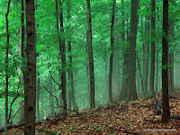
Best European Forests

European Forests
FORESTS IN EUROPE


Everyone is keen about how fantastic beach holidays are and the it isn’t difficult to go and to relax in the sun, with swimming in the sea and with watching the waves laping against the shores. On the other hand, while beaches are great and offer various relaxing facilities, forests offer some great places and locations to visit and discover too with wildlife, lush green, lots of walks, wildlife and a sense of peace by being close to nature. There are some spectacular "European Forests" that are worth to visit for anyone who enjoys this kind of scenery, either as a day out while you are at the particular destination, or as a place to stay in itself . Some of the famous European Forests are listed below:


The New Forest, England:
Map of New Forest
With its most suitable weather condition, average rainfall 838 mm/year. The "New Forest" is a very big forest which covers an  area of protected forest in England. It spans a large area and there are festivals and events which gives the opportunity to the city people to enjoy the nature. During the winter time there is a great Christmas display where the forest becomes a spectacular "Winter Wonderland".


The Black Forest, Germany:


Map of Schwarzwald
It is named  because of the thick conifers that blocks out the light in the forest, the black forest (Schwarz Wlad) is one of the most famous European forests and has a very "Magical Feel" especially during Christmas Time when the forest is covered with snow. Set in the mountains, and the birthplace of many stories and a wealth of food (such as the titular gateau and ham) this feels like the perfect setting for a fairy tale.


Belovezhskaya Pushcha, Belarus:     Белове́жская пу́ща 


Map of Belovezhskaya Pushcha
A forest which is in between Belarus and Poland.  On the Belarusian side the Biosphere Reserve occupies 1,771 km2 (684 sq mi); the core area covers 157 km2 (61 sq mi); the buffer zone 714 km2 (276 sq mi); and the transition zone 900 km2 (350 sq mi); the National Park and World Heritage Site comprises 876 km2 (338 sq mi). The Belavezhskaya Pushcha headquarters at Kamieniuki, Belarus include laboratory facilities and a zoo where wisent, konik (a semi-wild horse), wild boar, elk, and other indigenous animals may be viewed in enclosures of their natural habitat. There is also a small museum, restaurant, snack bar and hotel facilities (built during the Soviet era and currently in a state of disrepair). Due to the lack of facilities and little tourist stream in the country, few foreign tourists visit the Belarusian Pushcha annually.


Pirin National Park, Bulgaria:


Map of Pirin NP
Pirin is the second highest mountain range in Bulgaria after Rila (2,925 m) and the eighth highest in Europe. If you like exploring some European forests at a higher altitude then Pirin National Park is the place for you discovering caves, waterfalls and a limestone landscape all in a great pine wood forest.

Ardennes, France :
Map of Ardennes
Much of the Ardennes is covered in dense forests, with the mountains averaging around 350–500 m (1,148-1,640 ft) in height but rising to over 650 m (2,132 ft) in the boggy moors of the Hautes Fagnes (Hohes Venn) region of north-eastern Belgium. The region is typified by steep-sided valleys carved by swift-flowing rivers, the most prominent of which is the Meuse. Its most populous cities are Verviers in Belgium and Charleville-Mézières in France, both exceeding 50,000 inhabitants. The Ardennes is otherwise relatively sparsely populated, with few of the cities exceeding 10,000 inhabitants with a few exceptions like Eupen or Bastogne.

Friday, August 19, 2011

A Unique Experience - CAPRI / ITALY

Terrace view from Island Capri

CAPRI / ITALY

Capri is a Mountainous Island which is located 19 miles south of Naples (Napoli) , Italy, on the edge of the Gulf of Naples and west of the Sorrentine Peninsula and the stunning Amalfi Coast. 


The island is one of the famous resorts in Italy which is visited by many of tourists during spring and summer and is popular with local and international travelers, drawn here by the sun, sea and romance. It is easy to get around on the island. The ferries/hydrofoil are docking at the Marina Grande. All major hotels, cafes and restaurants are on the steep hill facing the harbour. 


Capri
There are also funiculars which will take you to the top of the island, Monte Solaro. 
At 589 meter you will have a spectacular view of the island, the bay of Naples, the bay of Salerno and towards Ischia. You can reach the top also by foot which is recommended to do by coming back down. 


Tragara
A short distance from Capri is Anacapri. It is worth to take a bus to get to this little settlement near Monte Solaro. Apart from this, the only other place you should visit on the island is the southern settlement of Marina Piccola. It has a big beach that is very popular. There are also other beaches on the island, Punta Carnea and Bagni di Tiberio.
Faraglioni
One of the 'Don't Miss' is Tragara which has a charming, panoramic road leads and to the Belvedere and the Faraglioni . The Faraglioni are three blocks of rock which have survived coastal landslides, erosion by the sea and all manner of atmospheric corrosion. The rocks have each been given a name: the first, still attached to the land, is called Stella, the second, separated from the first block by a stretch of sea; Faraglione di Mezzo and the third, Faraglione di Fuori or Scopolo, in other words the head or promontory stretching into the sea.


Blue Grotto : (Grotta Azzura)

The Blue Grotto is well known for its size, the intense blue tones of its interior and the magical silvery light which emanates from the objects immersed in its waters. Visitors can reach the Grotta Azzurra either by bus or taxi from Anacapri; or by boat from Marina Grande in one of the tour boats which stop at the entrance of the cave during the trip around the island.
In order to enter the Blue Grotto visitors get on small boats, with a capacity for two, maximum three, passengers and, lying on the bottom of the boat, enter the low and narrow mouth of the cave. Entrance to the cave is not possible in the presence of south westerly and mistral winds. The entrance to the Grotta Azzurra is formed by a small natural opening in the rocky wall, roughly 2 meters wide and 2 meters high.


Map of Capri
Getting to Capri
You can get to Capri from either Naples or Sorrento. Ferries and hydrofoils ply from these two destinations several times a day. From Naples the hydrofoil ride takes forty minutes and one and a half hours by ferry. From Sorrento the hydrofoil takes only 30 minutes.